Historical Map Collection
From 1990 to 2012, what are the historical mode share trends for populations living and working around Caltrain stations in the Bay Area?
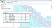
To visualize the commute-to-work mode share for residents and employees who live and work along the Caltrain rail corridor, a collection of maps has been published that display commuting trends over time for each of the 28 Caltrain stations. View the maps! Maps |
TDM Study

Projecting into the future, what policies and practices can be implemented to encourage further mode share shift for populations along the Caltrain corridor?
To develop a better understand of transportation demand management (TDM) programs that promote the use of alternative commute modes, interviews were conducted with transportation management associations (TMAs) and a report was compiled. Download the report! TDM Study |
